
This post combines
a description of Glen Ey with a series of walk guides. These were devised in
collaboration with the artist Gill Russell. We are considering the form of the walk
guides – specifically those produced for the Fife Arms Hotel, Braemar – and what
it might offer visitors in the future. This continues our work on what I call place-awareness. In practical terms, it
takes the form of the watershed, which makes the glen, and divides it into a
series of episodic walks. These are intended to encourage people to improvise,
as much as they are meant for following.
It is far better to plan your own walk, and far safer to choose where you wish to go.
It is far better to plan your own walk, and far safer to choose where you wish to go.

Click on the map to see a larger view. The walks are listed, with colour
coding, at the end of this introductory essay, here.

each river has a unique footprint
a watershed is an imperative: which way will you flow?
burns focus weather’s forces
rivers make tracks through glens; paths follow burns over hills
following a burn to its source relives the formation of a glen
the path goes from A-B; the burn goes from S-B, to N-U, and R-
watershed walks are inexhaustible
in Scots allt becomes auld, fitting for the old feeder of the river
burns are crisscrossed, lochs are star-crossed
rivers are syntax; hills are grammar
burns are enclosed passages interspersed with sounding pools
my father couldn’t see a burn pool without dreaming of trout
(AF and Gill Russell)

The Watershed
The first map, Ey watershed, was prepared by Gill in 2015, with the walks added in 2017. We use place-names slected from Adam Watson’s collections – the places the walker goes to return the name to its location. The line of the burns gives the skeleton of the routes to walk.
Many of the names do not appear on current OS maps, although some can be seen on earlier editions.
I have handwritten some of my translations on the second map of Glen Ey, a detail from the Ordnance Survey 1860 first edition ‘Braemar’, courtesy of the National Library of Scotland. As I’ve explained in other posts my approach to translating place-names differs from established conventions – though it is allied to the work of innovators, such as John Murray.
The nameless burns will have had names in the past; their absence speaks to the breach in communal memory. The photograph below the index, by Hannah Devereux, shows the prospect looking up the watershed towards the wilds of the Mounth.


Walking up the glen there are two farms named Ruighe an t-Seilich. Another ruin, Auchelie, is the last house in the glen to be permanently occupied. It is probably Dusky Field, though the land designation Quarter-portion Farm is possible. Ashie Brebner, who stayed here when it was a bothy, gives the pronunciation Acheree, and Macdonald thinks it closer to Achadh Chaorach, Sheep Field.
Where we think of a name as a single river and source, sometimes the wearing effects of time and the historical scouring of a community produce tributaries of meaning. Pinpointing a river’s source on the map isn’t always easy.
Deer have diminished the birch-wood of Coille Phìobair, Pipers Wood. The croft here was home to the ‘piping’ Lamont’s, who Jean Bain recalled: “lang ago there wid a been some folk – Pipers, Robbie Piper, an John Piper the tailor his brother, an his father wis cleared oot o Glen Ey at one time”.

This photograph looks over a tributary of Allt na Slaite, the Allt a’ Mhoir Ghrianaich, with, in the foreground, the ruins of Dail nam Fiadh, Deer Haugh, and, in the background, the lower slopes of Creag an Lochain, Lochan Crag – for which there is no lochan. The conspectus is viewed from a bridge that in the mid-distance, Double Fords Brig. An Ruighe Dubhe is near Allt a’ Mhóir Ghranaich. Glacan Poll Smìoraich, Wee Dip of the Dipping, for sheep, is on the east side of the burn, between Allt an Tuim Bhain and Allt a' Mhoir Ghrianaich.
There were shielings far up the Ey, beyond Altanour Lodge. Before the triumph of sheep some lairds encouraged summer-towns in the upper glens to discourage incursions into deer forests, but as the population swelled these dwellings tended to be occupied year-round. This fragile balance last as long as stock didn’t compete with deer for grazing, or until the stalking craze became so profitable that crofters were replaced by deer watchers or shepherds, as Robert Somers bitterly surmised: ‘Deer have received extended ranges, while men have been hunted within a narrower and still narrower circle.’
Alexander Fenton eulogized subsistence crofting, which had
‘…developed a kind of ecological cycle that could conserve resources, as long as it was not pressed too hard by factors like population growth. The infield and outfield produced bere and oats for ale and meal, and straw for fodder and for thatch. The infield was manured by animal dung from byre and stable droppings, rotted household refuse, and composted earthen middens based on turf cut with flauchter spades in outfield and moor. The ash from the peat fires went into the middens directly, or by way of the byres where it made a useful sponge for soaking up urine in the bedding. Collapsed turf walls, decayed turf and thatch from roofs and earthen or fail-dykes damaged by the hooves and horns of stock all followed the same path. The grass and weeds and young shoots of hill plants fed the beasts in summer without any special input from the farmer, and were converted into meat, milk, butter and cheese, manure, and wool and skins. There was an energy flow. The resources of the environment were channeled and converted through the stock and through domestic uses into nitrogenous material that helped the crops to grow better, and they in turn produced food and drink and fodder of which a goodly proportion found its way back into the cycle.’
Glen Ey was cleared to make way for deer in the 1830’s and 1840s; nine families were removed, along with thousands of sheep, ‘at the request of the shooting tenant, a Jew’, who Joe Dorward identified as John Lewis Ricardo, a relative of James, 4th Earl of Fife by marriage, who took the lease on the estate. The community of Meikle Inverey and Little Inverey were also barred from their traditional sheilings at Glen Connie, and Glen Cristie.
When Rev. A.R.G. Burn took this path over to Glen Shee, in July 1914, two different keepers aggressively dissuaded him from continuing, despite the drove road being a right of way. Burn offered his address written on a scrap of paper, and continued, being cursed as he disappeared.


Cross the bridge and head for the humpy knowe, Cnoc Chadail – not marked on the OS map, it is one of the names Adam was given by local informants. This is the ideal place to reflect on the significance of fairy lore. Even if it is only a natural drumlin it has the look of a tumulus. A young man was bewitched as he dozed here. Some time passed, as they say, and, in Jean Bain’s telling, ‘he heard the most lovely music, and he stoppit an listened, an then he went awa ower an gaed inti this hillock where the faeries wis. In some versions he sleeps for the archetypal spell of seven years, like Tam Lin; in others he dances before the shee release him. There is a discussion of the fairies of Glen Ey in a separate post.


This walk benefits from reading the discussion of sheiling above; we suggest marking the grid references on your map beforehand. The return route follows the Ey past the old farms of Ruighe an t-Seilich and Auchelie, returning to Inverey by Cnoc Chadail. A short detour up Linn of Connie waterfall.


A' Chailleach–Auchelie Loop
Start at Auchelie (walk in via Inverey) and follow the track upstream, past the Double Fords Brig and Creag an Fhuathais. About 0.5 km before Altanour Lodge cross the Ey at its confluence (NO 088828) with Allt Chailleach – the burn’s name is not marked on the OS map, but the Corrie is. Walk upstream to the boulder A' Chailleach, The Hag.
Follow the burn up Coire na Cailleach to the ridge and its views of the hills at the head of Glen Ey, including breast-shaped Mam nan Càrn, Mam-of-Screes. Return via Creag an Lochain to Auchelie.


There is a track on the north side of the Baddoch Burn descending down towards Glen Clunie, past the settlement of Corrieyaltie. You can return to Braemar this way, but our route is unusual in that it re-ascends the hill, following Allt a’ Choire Yaltie to the watershed that it shares with Allt na Slaite (c. NO124851), and then follows Allt na Slaite back down to Glen Ey, reaching the starting point at Double Fords Brig.

Coda
We thought we would finish with a homage to the old days. This is from a posting on cairngormwanderer, recalling the early days of skiing in the Cairngorms. Ashie Brebner describes how his party planned to climb Creag an Lochain, follow the ridge to Carn Creagach, and enjoy a downhill run from 3000 ft.
‘We hadn’t reckoned on the weather changing. This was in the days before transistors made it possible to carry a small radio for forecasts. We just had to take whatever came along. And come along it certainly did. By the time we had reached the top of Creag an Lochain, the wind was screaming from the north-east and then the snow hit us almost as a solid wall. There have only been a handful of times in my lifetime in the hills when I have experienced a blizzard of this magnitude. Any communication between us was impossible because of flapping hoods and the howling wind. Soon it became very difficult to remain in visual contact with the others and we just plodded along in our own little world. Eventually, just ahead of us, we could make out something of a greenish-blue colour. A few more steps and we all came to a halt on the edge of an icefield which sloped at an alarming angle down to our right.
Though we couldn’t communicate, we individually realized the wind had pushed us off the crest of the ridge and onto the headwall of the burn which comes off Carn Creagach and which earlier freeze and thaw conditions had converted to solid ice. This was beyond our skiing experience. The question was: how do we cross it? We still did not have the steel edges so were unsure whether we could get a grip with our by now slightly rounded edges. Do we attempt to cross it on ski, take our skis off, or perhaps turn into the wind and driving snow to regain the ridge? This last alternative, though practical, was not appealing. We each stood there deliberating, using our sticks to brace ourselves against the wind which threatened to drive us onto the ice. Doug Mollison made a decision. He bent down, took off his skis, slung them over his shoulder and edged onto the ice. Almost immediately the wind caught him, spun him round and he was off at high speed down the steep gully and out of our sight. We each stood there in silence, our slowing brains taking in the situation. We knew he would not come to real harm. There were no outcrops of any kind. He would have to find his own way back.’
(from an article originally written for the magazine Scottish Mountaineer)

The first map, Ey watershed, was prepared by Gill in 2015, with the walks added in 2017. We use place-names slected from Adam Watson’s collections – the places the walker goes to return the name to its location. The line of the burns gives the skeleton of the routes to walk.
Many of the names do not appear on current OS maps, although some can be seen on earlier editions.
I have handwritten some of my translations on the second map of Glen Ey, a detail from the Ordnance Survey 1860 first edition ‘Braemar’, courtesy of the National Library of Scotland. As I’ve explained in other posts my approach to translating place-names differs from established conventions – though it is allied to the work of innovators, such as John Murray.
The nameless burns will have had names in the past; their absence speaks to the breach in communal memory. The photograph below the index, by Hannah Devereux, shows the prospect looking up the watershed towards the wilds of the Mounth.


A burn’s name can charge a walk with a sense
of mission: does holly grow by Allt na Craoibhe-cuilinn, how chalybeate is Allt a Chuirn Dheirg? The watershed, like antlers, croc,
branching, crocach, offers
alternative routes, all the way to the source of the Ey, secretive Loch Nan Eun, birds loch, with its congregation of seagulls. The Ey’s largest
tributary, Allt Connie, may
be dogs burn, or kindling burn – Peter Drummond suggests kindling heather-roots
gathered by the sheiling, beneath Càrn Damhaireach, Rut Cairn.

Other
tributaries include Allt an Leathaid, Slope Burn, which rises in Glac Anton; Allt a Chuirn Dheirg, Red-hill Burn, belonging to Càrn Dearg; Alltan t-Sionnaich, Fox Burnie; Allt an Tuim
Bhain, White-knowe Burn; Allt na
Slaite, Slats Burn, named for the rods of willow, or osier, seilich,
discussed earlier; Allt Clais Chait,
Wildcat Burn; Allt Chailleach, Hags Burn, with its perpendicular
rock, A’ Chailleach; Allt Shios na
Moine, East-moss Burn, referring to the
peat-moor; Altanour Burn, Dun Burnie, beside the ruined lodge, and
Alltan Odhar, another Dun Burnie; poor wee Allt Cac Dubh, the Dark-shite Burn, probably named for its peaty water; and Allt Beinn Iutharn, Knifepoint Mountain Burn, flowing between Beinn Iutharn Beag and Mhòr, which derive from faobhar. Confusion between uarn and iutharn,
made the nonsensical Hills of Hell. The bigger Iutharn extends into a mile-long
horseshoe, with Mam nan Càrn and Iutharn Bheag, cupping the source of the Ey.

The Way In
There are two routes into Glen Ey. From Braemar the road winds east–west along the floodplain of the Dee. Opposite Creag Bhalg, Baggy Crag, or Crag of Bulges, is the ruin of Arderg, from An t-Ard Dearg, Red Top, for the bluff the burn flows down. A mile or so further, above Corriemulzie Dam, the skyline-V of Glac Anton runs a rough track into the Ey watershed, by the larch woods of Tom Anthon. Glac is hollow, defile, or bosom. Nearby, on An Goc, The Funnel, or Pipe, is a patch of hillside known as The Golds – only some sun-kissed gravel. Alternatively, continue on to Inverey and walk in between ravens and wildcats.
There are two routes into Glen Ey. From Braemar the road winds east–west along the floodplain of the Dee. Opposite Creag Bhalg, Baggy Crag, or Crag of Bulges, is the ruin of Arderg, from An t-Ard Dearg, Red Top, for the bluff the burn flows down. A mile or so further, above Corriemulzie Dam, the skyline-V of Glac Anton runs a rough track into the Ey watershed, by the larch woods of Tom Anthon. Glac is hollow, defile, or bosom. Nearby, on An Goc, The Funnel, or Pipe, is a patch of hillside known as The Golds – only some sun-kissed gravel. Alternatively, continue on to Inverey and walk in between ravens and wildcats.
Creag a’ Chait, Wildcat
Crag
Creag Fhithich, Ravens Crag

Names & Remains
The Ey watershed is a living memorial to shieling culture. Adam Watson summarizes: ‘Most of the formerly inhabited glens are now completely empty of people, and the rest are either virtually empty or severely depopulated. The hundreds of ruined farms are the most obvious reminder today.’ This is the perfect place to debate whether such regions should be designated ‘wild land’, given place-names and physical remains tell us they were settled and cultivated for hundreds of years, or re-classified ‘cleared land’. There were clearances in this glen but, although it is little comfort, for the most part, Deeside folk were pulled out of the region by need, rather than pushed out by force. Using Adam’s work and help from Joe Dorward we mapped the dwellings of the Ey, some of which share names with the burns. We hope that walkers will add these grid references to their maps, and plan a route to see the ruins.
The Ey watershed is a living memorial to shieling culture. Adam Watson summarizes: ‘Most of the formerly inhabited glens are now completely empty of people, and the rest are either virtually empty or severely depopulated. The hundreds of ruined farms are the most obvious reminder today.’ This is the perfect place to debate whether such regions should be designated ‘wild land’, given place-names and physical remains tell us they were settled and cultivated for hundreds of years, or re-classified ‘cleared land’. There were clearances in this glen but, although it is little comfort, for the most part, Deeside folk were pulled out of the region by need, rather than pushed out by force. Using Adam’s work and help from Joe Dorward we mapped the dwellings of the Ey, some of which share names with the burns. We hope that walkers will add these grid references to their maps, and plan a route to see the ruins.
Walking up the glen there are two farms named Ruighe an t-Seilich. Another ruin, Auchelie, is the last house in the glen to be permanently occupied. It is probably Dusky Field, though the land designation Quarter-portion Farm is possible. Ashie Brebner, who stayed here when it was a bothy, gives the pronunciation Acheree, and Macdonald thinks it closer to Achadh Chaorach, Sheep Field.
Where we think of a name as a single river and source, sometimes the wearing effects of time and the historical scouring of a community produce tributaries of meaning. Pinpointing a river’s source on the map isn’t always easy.
Deer have diminished the birch-wood of Coille Phìobair, Pipers Wood. The croft here was home to the ‘piping’ Lamont’s, who Jean Bain recalled: “lang ago there wid a been some folk – Pipers, Robbie Piper, an John Piper the tailor his brother, an his father wis cleared oot o Glen Ey at one time”.
Allt a’ Mhoir Ghrianaich, Sunnyside Burn
lay me down by the burn
where the
sun likes to rest

This photograph looks over a tributary of Allt na Slaite, the Allt a’ Mhoir Ghrianaich, with, in the foreground, the ruins of Dail nam Fiadh, Deer Haugh, and, in the background, the lower slopes of Creag an Lochain, Lochan Crag – for which there is no lochan. The conspectus is viewed from a bridge that in the mid-distance, Double Fords Brig. An Ruighe Dubhe is near Allt a’ Mhóir Ghranaich. Glacan Poll Smìoraich, Wee Dip of the Dipping, for sheep, is on the east side of the burn, between Allt an Tuim Bhain and Allt a' Mhoir Ghrianaich.
There were shielings far up the Ey, beyond Altanour Lodge. Before the triumph of sheep some lairds encouraged summer-towns in the upper glens to discourage incursions into deer forests, but as the population swelled these dwellings tended to be occupied year-round. This fragile balance last as long as stock didn’t compete with deer for grazing, or until the stalking craze became so profitable that crofters were replaced by deer watchers or shepherds, as Robert Somers bitterly surmised: ‘Deer have received extended ranges, while men have been hunted within a narrower and still narrower circle.’
Alexander Fenton eulogized subsistence crofting, which had
‘…developed a kind of ecological cycle that could conserve resources, as long as it was not pressed too hard by factors like population growth. The infield and outfield produced bere and oats for ale and meal, and straw for fodder and for thatch. The infield was manured by animal dung from byre and stable droppings, rotted household refuse, and composted earthen middens based on turf cut with flauchter spades in outfield and moor. The ash from the peat fires went into the middens directly, or by way of the byres where it made a useful sponge for soaking up urine in the bedding. Collapsed turf walls, decayed turf and thatch from roofs and earthen or fail-dykes damaged by the hooves and horns of stock all followed the same path. The grass and weeds and young shoots of hill plants fed the beasts in summer without any special input from the farmer, and were converted into meat, milk, butter and cheese, manure, and wool and skins. There was an energy flow. The resources of the environment were channeled and converted through the stock and through domestic uses into nitrogenous material that helped the crops to grow better, and they in turn produced food and drink and fodder of which a goodly proportion found its way back into the cycle.’
Glen Ey was cleared to make way for deer in the 1830’s and 1840s; nine families were removed, along with thousands of sheep, ‘at the request of the shooting tenant, a Jew’, who Joe Dorward identified as John Lewis Ricardo, a relative of James, 4th Earl of Fife by marriage, who took the lease on the estate. The community of Meikle Inverey and Little Inverey were also barred from their traditional sheilings at Glen Connie, and Glen Cristie.
When Rev. A.R.G. Burn took this path over to Glen Shee, in July 1914, two different keepers aggressively dissuaded him from continuing, despite the drove road being a right of way. Burn offered his address written on a scrap of paper, and continued, being cursed as he disappeared.

Gill
and I have collaborated on a series of conspectus in the region, to be included
in the forthcoming Gathering book.
This one was composed from Double
Fords Brig, which
can be found at NO 100849. Although a conspectus has the
appearance of a logical measure it is, in reality, a subjective human
assessment of the hill’s in view – an measure of how small hills seem large
when their near and far mountains seem small, rather like the inhabitant of
Raasay who claimed Dùn Caan was far higher than the Cuillin, for every morning
he could see it was so.
The Walks
These walks were composed by Gill, and feature some of the place-names discussed in above, and in the Gathering book.
The Walks
These walks were composed by Gill, and feature some of the place-names discussed in above, and in the Gathering book.


Short walk around Tom Anton
Route: Corriemulzie–Inverey–Corriemulzie: via Glac Anthon
Start: Corriemulzie dam. Walk up Glac Anton past the old Limekiln; drop down to the Ey, with the larch wood on your right. Return along the minor hill road circling around Tom Anton, headed east, downstream.
Linn of Corriemulzie, Mill Corrie Falls, is below the main road.

Lower Ey Bridge–Coire an
t-Sìdhein–Cnoc Chadail
A short walk through the region of the Sìth, fairies, from Inverey to Cnoc Chadail, the knowe just beyond Lower Ey bridge and back again.
A short walk through the region of the Sìth, fairies, from Inverey to Cnoc Chadail, the knowe just beyond Lower Ey bridge and back again.
A DISTURBANCE IN THE
ATMOSPHERE : SHEE
Cnoc
Chadail, Sleepful Knowe
Cross the bridge and head for the humpy knowe, Cnoc Chadail – not marked on the OS map, it is one of the names Adam was given by local informants. This is the ideal place to reflect on the significance of fairy lore. Even if it is only a natural drumlin it has the look of a tumulus. A young man was bewitched as he dozed here. Some time passed, as they say, and, in Jean Bain’s telling, ‘he heard the most lovely music, and he stoppit an listened, an then he went awa ower an gaed inti this hillock where the faeries wis. In some versions he sleeps for the archetypal spell of seven years, like Tam Lin; in others he dances before the shee release him. There is a discussion of the fairies of Glen Ey in a separate post.

Circular walk to the Upper Ey
conspectus
This shieling walk begins at Inverey. It can be combined with the first walk, entering the Ey watershed via Corriemulzie and Glac Anton. The main route passes Leth-taobh Cathaidh, Half-side of snowdrifts (NO 097873), contours around Càrn Mor, crosses over Càrn Dearg, and then descends to Dail nam Fiadh to upper Glen Ey. Pause at Double Fords Brig , our conspectus – the conspectus appears in the essay, above, and the bridge can be seen in the photo below. Note Creag an Fhuathais, Crag of the Spectre – the bogle was banished by a priest, who fixed a crucifix on the hilltop.
This shieling walk begins at Inverey. It can be combined with the first walk, entering the Ey watershed via Corriemulzie and Glac Anton. The main route passes Leth-taobh Cathaidh, Half-side of snowdrifts (NO 097873), contours around Càrn Mor, crosses over Càrn Dearg, and then descends to Dail nam Fiadh to upper Glen Ey. Pause at Double Fords Brig , our conspectus – the conspectus appears in the essay, above, and the bridge can be seen in the photo below. Note Creag an Fhuathais, Crag of the Spectre – the bogle was banished by a priest, who fixed a crucifix on the hilltop.

This walk benefits from reading the discussion of sheiling above; we suggest marking the grid references on your map beforehand. The return route follows the Ey past the old farms of Ruighe an t-Seilich and Auchelie, returning to Inverey by Cnoc Chadail. A short detour up Linn of Connie waterfall.
Allt Connie–Auchelie:
circuit around Càrn Bhithir
Start at Inverey and go along the west side of the Ey as far as its confluence with Allt Connie near Drochaid an Léum. Follow Allt Connie past its confluence with Allt Cristie, round to the south side of Càrn Bhithir, Sharp Cairn. A short ascent east over the bealach allows you to cross over to the old peat track to Auchelie Moss, down to the ruins of Auchelie. The route then descends back down to Inverey.
At Drochaid an Léum (NO 086884) there was formerly a bridge where the Black Colonel, and nearby is his hideaway, The Colonels Bed.

A' Chailleach–Auchelie Loop
Start at Auchelie (walk in via Inverey) and follow the track upstream, past the Double Fords Brig and Creag an Fhuathais. About 0.5 km before Altanour Lodge cross the Ey at its confluence (NO 088828) with Allt Chailleach – the burn’s name is not marked on the OS map, but the Corrie is. Walk upstream to the boulder A' Chailleach, The Hag.
Follow the burn up Coire na Cailleach to the ridge and its views of the hills at the head of Glen Ey, including breast-shaped Mam nan Càrn, Mam-of-Screes. Return via Creag an Lochain to Auchelie.

Circuit Walk: Ey, Baddoch Burn and Clunie
Water
This is an arduous walk, and a long one, unless you camp. It combines watercourses and watersheds connecting Glen Ey with Glen Clunie.
Start at the Double Fords Brig (via Inverey) and continue upstream following the Ey past Altanour Lodge until it’s name changes to Allt Cac Dubh, named for the peaty water. This divides into several small watercourses. Turn southwest, following the burn leading to Loch nan Euan, Birds Loch – from here there is an option to continue down Glen Taitneach, Pleasant or Lovely Glen, to The Spittal of Glenshee and Tom Diarmid.
If you are following our route then turn east along another nameless burn (NO 07680 79209), which eventually leads to the high watershed the Ey shares with the Baddoch Burn ((NO 07963 79259), on the south of An Socach, Big Neb. The descent follows the watercourses that merge into the Baddoch Burn, Thickets Burn. Gill, Ed Workman and Alec collected water samples from all of these burns as a gift for Iwan Wirth.

There is a track on the north side of the Baddoch Burn descending down towards Glen Clunie, past the settlement of Corrieyaltie. You can return to Braemar this way, but our route is unusual in that it re-ascends the hill, following Allt a’ Choire Yaltie to the watershed that it shares with Allt na Slaite (c. NO124851), and then follows Allt na Slaite back down to Glen Ey, reaching the starting point at Double Fords Brig.

Coda
We thought we would finish with a homage to the old days. This is from a posting on cairngormwanderer, recalling the early days of skiing in the Cairngorms. Ashie Brebner describes how his party planned to climb Creag an Lochain, follow the ridge to Carn Creagach, and enjoy a downhill run from 3000 ft.
‘We hadn’t reckoned on the weather changing. This was in the days before transistors made it possible to carry a small radio for forecasts. We just had to take whatever came along. And come along it certainly did. By the time we had reached the top of Creag an Lochain, the wind was screaming from the north-east and then the snow hit us almost as a solid wall. There have only been a handful of times in my lifetime in the hills when I have experienced a blizzard of this magnitude. Any communication between us was impossible because of flapping hoods and the howling wind. Soon it became very difficult to remain in visual contact with the others and we just plodded along in our own little world. Eventually, just ahead of us, we could make out something of a greenish-blue colour. A few more steps and we all came to a halt on the edge of an icefield which sloped at an alarming angle down to our right.
Though we couldn’t communicate, we individually realized the wind had pushed us off the crest of the ridge and onto the headwall of the burn which comes off Carn Creagach and which earlier freeze and thaw conditions had converted to solid ice. This was beyond our skiing experience. The question was: how do we cross it? We still did not have the steel edges so were unsure whether we could get a grip with our by now slightly rounded edges. Do we attempt to cross it on ski, take our skis off, or perhaps turn into the wind and driving snow to regain the ridge? This last alternative, though practical, was not appealing. We each stood there deliberating, using our sticks to brace ourselves against the wind which threatened to drive us onto the ice. Doug Mollison made a decision. He bent down, took off his skis, slung them over his shoulder and edged onto the ice. Almost immediately the wind caught him, spun him round and he was off at high speed down the steep gully and out of our sight. We each stood there in silence, our slowing brains taking in the situation. We knew he would not come to real harm. There were no outcrops of any kind. He would have to find his own way back.’
(from an article originally written for the magazine Scottish Mountaineer)

bibliography
John R. Allan: North-east Lowlands of Scotland
Ashie Brebner: ‘On ski in the Cairngorms’, Scottish Mountaineer
James Coutts: Dictionary of Deeside
Francis C. Diack: The Inscriptions of Pictland
Joe Dorward: Lowdown on the Upland of Mar
Peter Drummond: Scottish Hill Names
Alexander Fenton: Country life in Scotland
William Forsyth: In the Shadow of Cairngorm
James Macdonald: Place-names of West
Aberdeenshire
Robert MacFarlane: Landmarks
Ian Murray: The Dee From the Far Cairngorms
John
Murray: Reading the Gaelic Language
WFH Nicolaisen: In the Beginning was the Name
Sheila Sedgwick: Living Stones
Robert Somers: Letters from the Highlands on the Famine of 1846
Adam Watson: Caring for the High Cairngorms
Adam Watson: The Cairngorms, SMC Guide
Adam Watson: The Place Names of Upper Deeside
Adam Watson and Ian Murray: Place-name Discoveries
Adam Watson & R.D. Clement: Aberdeenshire Gaelic
photography
Corriemulzie Dam, Glen Ey, Hannah Devereux,
2015
Ach a’ Chéiridh, Glen Ey, Hannah Devereux,
2015
Glen Ey view, Hannah Devereux, 2015
Càrn Damhaireach, Glen Ey, Hannah Devereux,
2015
Arderg, Glen Ey, Hannah Devereux, 2015
Creag a' Chait, Glen Ey, Hannah Devereux, 2015
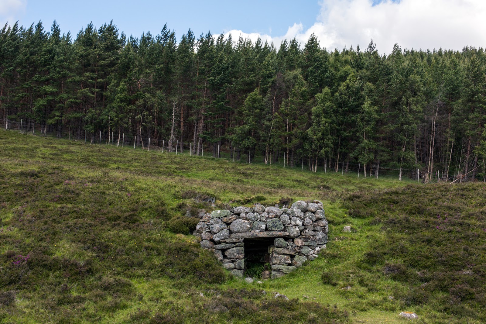
Beehives, Glen Ey, Hannah Devereux, 2015
Allt a’ Mhoir Ghrianaich, Glen Ey, Hannah
Devereux, 2015
Glen Ey, Hannah Devereux, 2015
Glac Anthon, Glen Ey, Hannah Devereux, 2015
Cnoc Chadail, Glen Ey, Hannah Devereux, 2015
Glen Ey, Hannah Devereux, 2015
Creag an Fhuathais, Glen Ey, Hannah Devereux,
2015
Glen Ey, Hannah Devereux, 2015
Glen Ey, Hannah Devereux, 2015
Clunie tributaries water samples, 2014
Gill Russell, Glen Ey, Hannah Devereux, 2015
Charlie Smith, courtesy of Ashie Brebner, c.
1953
images
Glen Ey walk, Gill Russell, 2017
Glen Ey walk, Gill Russell, 2017
Glen Ey map, Alec Finlay, 2015
Glen Ey conspectus,
Alec Finlay, 2016
Glen Ey walk map key, Gill Russell, 2017
Glen Ey colour walk map key, Gill Russell,
2017
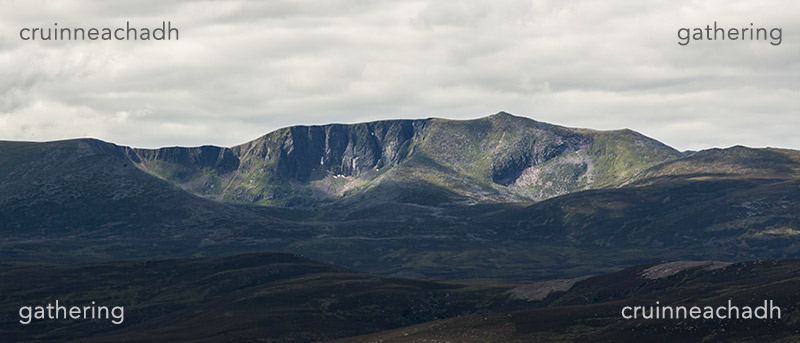
Gathering was commissioned by Hauser & Wirth, for the
Fife Arms Hotel, Braemar; the project was launched in 2015 and will conclude in
2018.
The artist residency at University of Aberdeen is funded by The Leverhulme Trust; the project was launched in July 2016 and will conclude May 2017.
The artist residency at University of Aberdeen is funded by The Leverhulme Trust; the project was launched in July 2016 and will conclude May 2017.